| Date: | 15 July 2019 | Weather: | 21’C, sun and cloud |
| Height gain: | 1,962 ft | Distance: | 12.2 miles |
| Time taken: | 6.5 hours | Wainwrights: | – |
This is our sixth walk of the Coast to Coast and we pick up from where we left off three weeks ago. It’s a lovely warm day with not much wind. The driving to end and start points is still relatively straight forward at this point and we’re walking by 11 am, including a stop for food at Bryson’s in Kirby Stephen.
This is a “traditional” section of the Coast to Coast (i.e. one that hardened walkers would do in one day) but we don’t expect to see many fellow walkers starting at this late hour.
We set off from the large, free car park in Kirkby Stephen, past the loos (good planning) and across a little bridge with a helpful sign letting Coast to Coaster’s know how they’re doing so far:
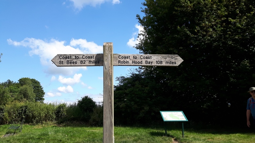
We’ll be halfway through by the time we reach Keld (or would be, at this point we haven’t done the start yet).
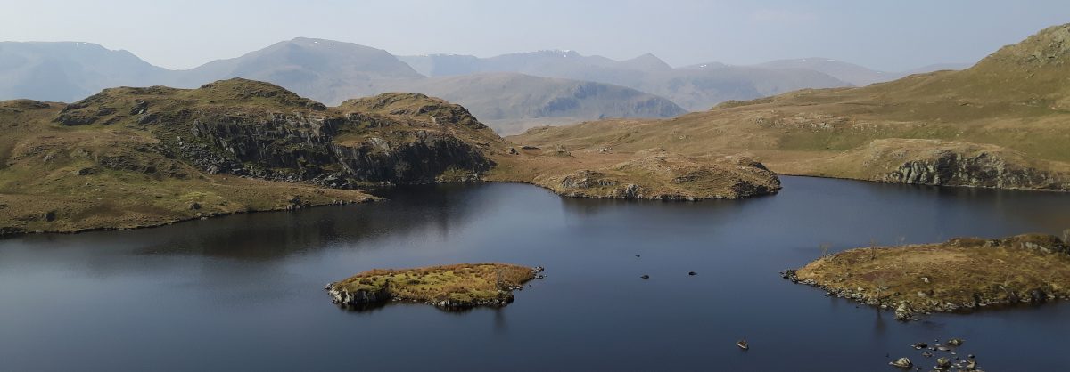
The path takes us up fields and onto a quiet road through the village of Nateby. It’s then onto an even quieter road, for walkers and farm vehicles only, which pitches gently upwards as we climb 1,600ft over the five miles to Nine Standards Rigg. The views behind us back over Kirkby Stephen are lovely, and we can see Cross Fell and the route of the Pennine Way to our left as we climb:
The walking couldn’t be easier, apart from the fact it is all uphill, and while the sun is shining there is enough breeze to feel comfortable. I, however, am really struggling today – not just a runaway heart rate but feeling lacking in energy as well. The going is slow as I stop every 50ft or so, and S is very patient. After only 800ft of climbing (but well over an hour of walking) I decide I need food so sit on the verge and eat half a cheese scone. It helps a bit, I’m still slow but not feeling like I’m not getting anywhere as I was before.
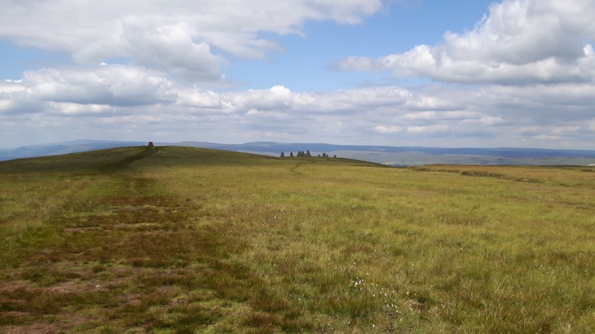
I consult the map as I munch my scone and work out we have another 700ft of ascent to the stones. They soon come into view and don’t seem that far above us, but they keep running away. As we reach the crest of a rise there’s another rise behind it and it seems like we’ll never get there. I’m slowing down again and S is also ready for lunch, but I’m determined it’ll be eaten at the stones. Finally, at 1.30 pm, we make it:
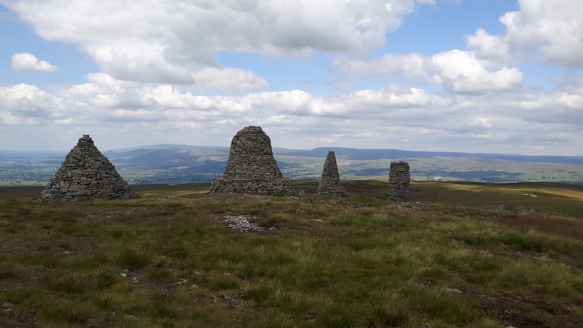
The Nine Standards Rigg is a line of cairns which stand on the edge of the escarpment just north of the highest point. They look like they might have been refreshed recently, the stone looks very orderly and clean. They look like large beehives – I had been expecting standing stones (and ever hopeful of falling through one into another time for a bit of adventure).
The Visit Cumbria website tells me that their origin is a mystery. According to Wainwright they are very ancient and are marked on 18th century maps. One theory is that they were constructed by the Roman army to look like troops from a distance.
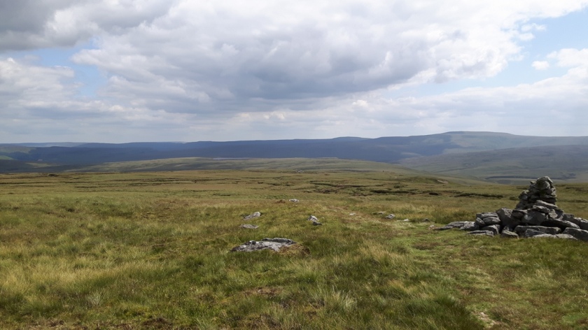
They are striking, and make a good point to flop down and enjoy some food. The ledges around the stones are a bit narrow and high for comfort so I find a comfy dip in the grass and admire the stones from a few feet away. The first people we’ve seen all day are up here – we saw one party making their way ahead of us and there’s a quiet young couple perched on the far stone. The older party are chattering away and we’re glad when they move off to carry on their walk.
We eat our food, sunbathe a bit (well, one of us does, i.e. me), wander around the stones and take lots of photos of both the stones and the views and eventually set off again on our route, looking back at the stones as we go:
The cairn on its own is a separate one built to commemorate the marriage of Prince Charles and Lady Diana Spencer in 1981 with a metal plaque on the top that points out all the hills around us. We confirm we were right in spotting Cross Fell on the way up and try to see as far as Scafell Pike, but it’s got a bit hazy over the Lakes. The cairn says that Pen y Ghent is to our right – if it is then it’s doing a very good impression of Ingleborough.
It’s downhill all the way from here, much to my relief, but as usual lunch has sorted me out and I have far more energy in the afternoons. I love the moorland that surrounds us but, despite it being remarkably dry, the ups and downs of the peaty ground is quite wearing as we undulate round the wetter bits trying to keep to what looks like the path that others have walked.
We reach a signpost which has three different routes – Green route for December to April, Red route for May to July and Blue route for August to November. It being July, we happily take the Red route, Wainwright’s original. The peaty ground still undulates and we pass a few cairns to reassure us we’re still on the right route on the wall to wall moorland:
We reach a junction with a stony path and turn left towards Ravenseat – the going is a bit easier now as the path changes between stony and then grassy. We stop for afternoon tea as we cross Ney Gill. Brysons might do more interesting looking cakes than the Apple Pie shop, but boy are they sweet. It gives me boundless energy for the rest of the walk, but I feel like I’ve just dug a spoon into a bag of sugar and eaten it.
It looks like we should go through a gate into a farmer’s field to get to Ravenseat but we err on the cautious side and take a broad stony path up and then down again to the road and approach the farm buildings from the front – probably 50ft we didn’t need to climb but no route finding issues to deal with.
The farm offers cream teas and hot and cold drinks and has inviting looking tables outside, but we stomp on and find the footpath to Keld. It goes upwards, which isn’t popular with S who looks like he’s feeling like I was this morning. The path levels out and I keep expecting to see Keld below us but it never comes into view. I manage to hit a slippy stone as we cross a little stream and fall onto hands and knees in the very brown water. I clean the mud (+ sheep poo?) off my hands in the water anyway and carry on my way – my wet trousers will be dry in no time in the July sun.
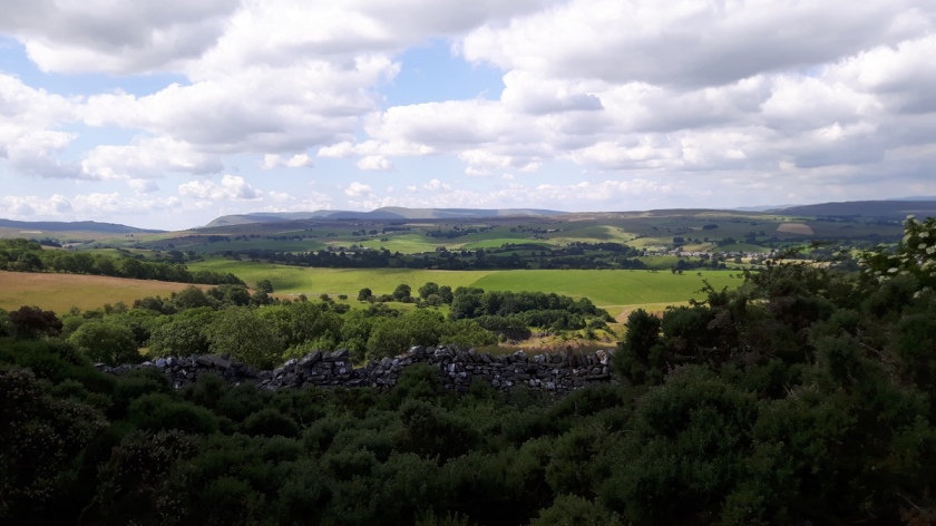
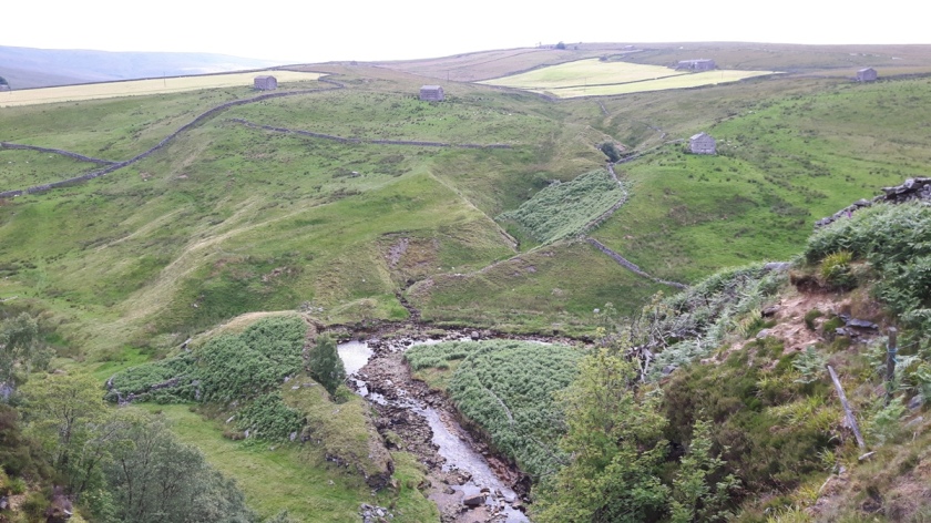
The view into the valley below us is impressive, and there are lots of little barns dotted in the landscape:
We trudge on and finally meet the road we drove into Keld on this morning. Still just over a mile to go and of course the road points upwards. I think I can see the sign for the small road off left to Keld but no, it’s the sign for the road off to the Tan Hill Inn. We pass a campsite with impressive looking yurts and people in their shorts sitting outside with cool drinks and their noses in books – looks very relaxing. Finally the Keld sign appears and we swing left down the road and into the village:
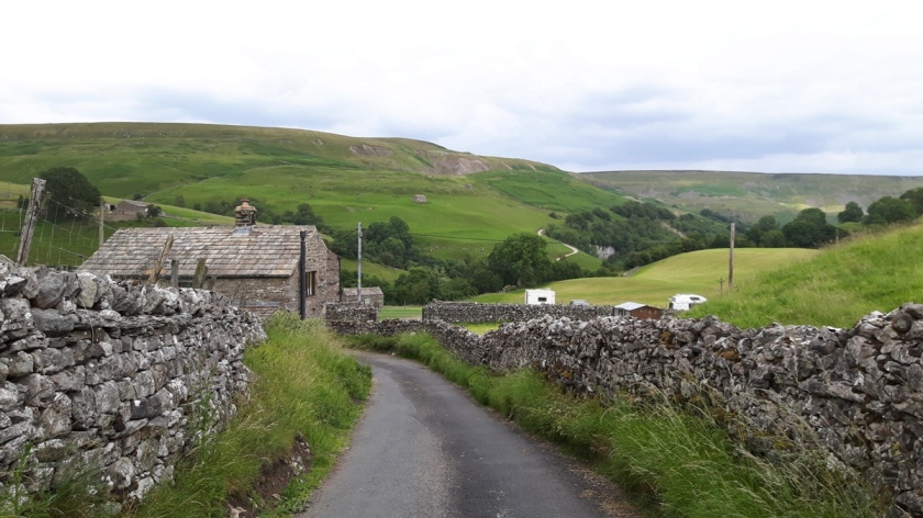
Keld is a tiny place in a very beautiful setting and the point where the Pennine Way and Coast to Coast cross each other. I have no memory at all of it, although S says he has memories of reaching it feeling exhausted and says he feels exactly the same today. For a small village it has a great car park – provided by a farmer I suspect, with toilets and everything and a very modest all day charge.
I really enjoyed this section of the walk – just wish I hadn’t been quite so out of energy for those first five uphill miles.

You must be logged in to post a comment.